By Moriah Amit, M.S.L.I.S., Senior Reference Services Librarian, Genealogy Coordinator, Center for Jewish History

Did any of your Jewish ancestors settle in New York City? Have you
wondered what life was like for those ancestors who settled on the Lower
East Side or any of the dozens of other Jewish neighborhoods that
emerged in the city’s five boroughs in the late 19th and early 20th
centuries? In trying to gain a better understanding of one’s immigrant
ancestors’ experiences, one of the key questions that arises is “Which
synagogue did my ancestors attend?” As that information was not recorded
in civil documents and was rarely passed down in family stories, this
is a challenging question to tackle, with a potential pool of hundreds
of synagogues to choose from during the peak period of Jewish
immigration to New York, from around 1880 to 1924. However, since most
practicing Jews preferred to attend a synagogue within walking distance
of their homes, narrowing the potential pool to those located within a
limited geographical radius around one’s ancestors’ home(s) seems like a
logical first step toward identifying their synagogue(s). While one
can find many listings of New York’s synagogues in directories spanning
from the early 19th century to the present, it is not possible to
conceive of how they are spatially arranged across the city without
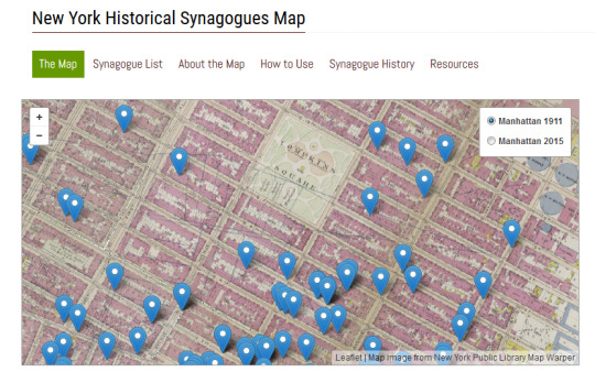
viewing them on a map. To fill this need, the Ackman & Ziff Family
Genealogy Institute at the Center for Jewish History, spearheaded by its
Senior Reference Services Librarian, Moriah Amit, developed and
recently launched a searchable online map of New York’s historical
synagogues. At present, the map only contains synagogues that were
active in Manhattan between 1900 and 1918, but the Institute plans to
expand the map to encompass all five boroughs and a longer timespan.
Take a step back in time and explore the religious realm of your
ancestors’ lives at synagoguemap.cjh.org.
