Jewish Populations in Europe, 1750 – 1950: Maps for Your Research
Monday, December 14 6:30pm
With
the frequently changing borders of European countries in the 18th –
20th centuries, it can be a challenge to understand the locations of
Jewish communities of interest within those countries. On behalf of the
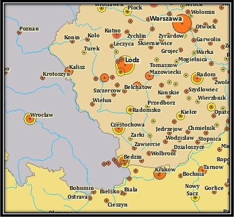
International Institute for Jewish Genealogy, Sandy Crystall developed a
series of digital maps that show the populations of as many as 700
Jewish communities, along with the contemporaneous boundaries of
countries and smaller administrative units (provinces), serving as
snapshots of the geopolitical context of Jewish demographics over the
course of this tumultuous period. This presentation will provide
information about the creation of these digital maps and how they can be
used to assist in genealogical research. Sandy Crystall has a
post-baccalaureate certificate in Geographic Information Systems and has
been an amateur genealogist for more than 25 years.
Reservations required: http://www.smarttix.com/show.aspx?showcode=jew3D3&ss=1
Image: Sandy Crystall